| Via Santa Colomba 2 - 35018 San Martino di Lupari (PD)
|
|
|
Summary
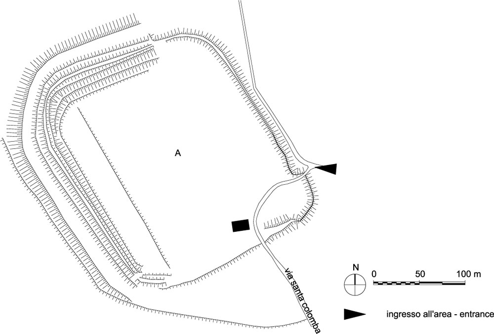
The site at “Le Motte di Sotto” allows the visit to a pre and protohistoric settlement. The site is constituted by an embankment that was built during Bronze age and which was restructured at the beginning of Iron age. It also includes the living area contained therein, which today is not visible in its structural elements.History of research
The site was discovered at the end of the XIX century by the geologist Tellini. Between 1984 and 1986 the General Direction for Archaeological Heritage in the Veneto region conducted three archaeological campaigns which allowed to verify the nature and the chronology of the site.
Urban and geographical context
The pre and proto-historic site at “Le Motte” is located close to the springs area, in the middle plains, at an average altitude of 50 metres above sea level and between the municipalities of “San Martino di Lupari” and “Castello di Godego”.
Chronology
XIII-XII sec. B.C. (Bronze age)
IX-VIII sec. B.C. (Iron age)
|
 |  |
|
Visiting
Visitability: Esterno e Interno;
Ticket: No;
 School access School access
|
Recommended tour time (minutes): 80 |
|
Services for visitors
|
Educational Services
 Information boards Information boards |
Bibliography
| Valery C., Marchetti P. 1979, Un abitato dell'età del Bronzo presso le Motte di Castello di Godego, Treviso. |
| Bianchin Citton E. 1985, San Martino di Lupari (PD), Castello di Godego (TV) - Le Motte di Sotto, in Aquileia Nostra, LVI, pp. coll. 460-462. |
| Bianchin Citton E., Pasqualin A. 1990, Il villaggio arginato de "Le Motte di Sotto": geografia, morfologia, tutela, San Martino di Lupari. |
| Veneto e Friuli-Venezia Giulia (Guide Archeologiche Preistoria e Protostoria in Italia) 1996, a cura di Aspes A., Fasani L., Forlì, pp. 166-173. |
| Bonetto J. 2009, Veneto (Archeologia delle Regioni d'Italia), Roma, pp. 481-482. |
