

|
|||||||
|
(Italiano) Belluno(Italiano) Belluno
(Italiano) Padova(Italiano) Padova
(Italiano) Rovigo(Italiano) Rovigo
(Italiano) Treviso(Italiano) Treviso
(Italiano) Venezia(Italiano) Venezia
(Italiano) Verona(Italiano) Verona
(Italiano) Vicenza(Italiano) Vicenza
|
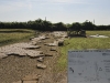
The coastPliny the Elder (Naturalis Historia, III, 126-130; VI, 218) called Venetia maritima the coast line of Veneto. This coast is long, 130-150 km, and it is characterised by numerous lagoons that were identified as specific geographic individualities, named Venetia. The same word was used to point specifically at the Veneto lagoon or more broadly at the area between the sea and the inland.  Veduta di spazi lagunari con barene e ghebbi The issue of the extension of the lagoon in the pre-historic age, and towards the end of the Roman domination, has been matter of heated debate amongst scholars. Some scholars went to extremes of argument in favour of a complete immersion of the land of the coast. However, this is the only hypothesis that can be fully rejected, because archaeological and morphological studies of the territory go clearly against it. Also Livy (Ab Urbe condita, X, 2, 5-6) claims that between the sea and the inland there was a series of tenue praetentum litus. Stagna … inrigua aestibus maritimis and a landscape made of agros haud procul campestres, ulteriora colles. Strabo’s mention of lagoons and limnothalatta are also further evidence for the existence of the lagoon (Geographia, V, 1, 5; V, 1, 7). It is worth debating the chronology of evident changes of the location of the lagoon because of the advance and retreat of the coastline. With certainty in the late Iron Age the sea receded and for this reason during Roman times many pieces of land emerged and were populated very close to the margins of the northern lagoon, in particular around S. Eramo, Burano, Torcello and Altino. The lagoon areas expanded a second time in the V-VI centuries and caused a decrease in population.  Le lagune venete All the amphibious areas became incredibly useful for communication, as they ensured an excellent mediation between the open sea and the inland, and also safe navigation in the entire northern Adriatic arch. These areas would have been steadily inhabited before the time of Venetian supremacy because of many Roman and Greek discoveries. In contrast to what might be thought, they were suitable for steady and structured settlement. The flood-tide ensured a continuous hydraulic refill of the Para lagoon areas and islands.. The fresh water is mentioned also by Vitruvius as a means of exceptional healthiness of the Gallicae paludes (De architectura, I, 4, 11).
|


|
|||||
|
Crediti | Mappa del sito | Admin |
|||||||