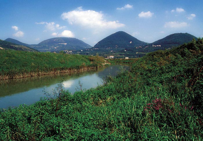
Polybius describes the plains of Veneto as the most vast and fertile of Europe (Historiae, II, 14, 7). These plains occupy more than half of the region (around 56 %, which means 10.371 kmq). They are in the southern and central area of the region, between the lagoon and the mountains. Thus, in other words, the plain goes from the south-western borders with Lombardi and Emilia to the north-eastern area of the region next to Friuli. Its size decreases from 110 to 55 km. The plain has its origins in the last two million years owing to the fact that rivers transported enormous quantities of rubble downstream, so that the entire sea area located between Alps and Apennines was covered, and this created the Po Valley. This valley displays an absolutely homogeneous territory that slopes slightly towards the sea in the South-East, and so in rich of water. Because of these characteristics it is very suitable for agriculture. Indeed, agriculture is the main resource of the Po Valley.
The Berici and Euganei hills stick out in this vast and homogeneous territory. The Berici rarely exceed 4000m and they are formed of limestone rocks. The Euganei reach 603 m at the Venda Peak and have volcanic origins. They are particularly well-known because of their hot springs ( especially around Montegrotto and Abano),which played a fundamental role in the regional development.

Sezione tracciata lungo la pianura veneta (da Spresiano per Treviso fino alle foci del Sile in Laguna) con schema stratigrafico della successione dei depositi (ghiaie, sabbie, argille e limi)
Different hydrological systems and chance of settlement allow two separate areas to be recognised: the so called ‘low valley’, characterised by impermeable soil (slime and clay) and by plentiful superficial water and rivers keen to break their banks; and the so called “high valley” characterised by sand and gravel and very dry on the surface, but in rich of underground water. These two distinct areas are divided by a third band, called the “middle plain” and has alternating sand with slimes and clay. At the far north of this band (an area called “the line of the spring water”) the underground water emerges on the surface creating the characteristic phenomenon of the springs.
Il testo e le immagini (con referenze fotografiche) sono tratti da:
J. Bonetto, I. Venturini, L. Zaghetto, Veneto, Archeologia delle Regioni d’Italia, Istituto Poligrafico e Zecca dello Stato, Roma 2009.


